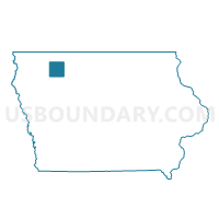
DICKENS Voting District, Clay County, Iowa
About
Outline

Summary
| Unique Area Identifier | 581801 |
| Name | DICKENS Voting District |
| County | Clay County |
| State | Iowa |
| Area (square miles) | 0.84 |
| Land Area (square miles) | 0.84 |
| Water Area (square miles) | 0.00 |
| % of Land Area | 100.00 |
| % of Water Area | 0.00 |
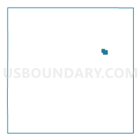
| Latitude of the Internal Point | 43.13382730 |
| Longtitude of the Internal Point | -95.02219180 |
Maps

Graphs
Select a template below for downloading or customizing gragh for DICKENS Voting District, Clay County, Iowa